Hello dear reader. Never before did I think that I would have to write these lines. For quite a long time I did not dare to write down everything that I was destined to discover, if you can even call it that. I still sometimes wonder if I’ve gone crazy.
One evening my daughter came up to me with a request to show me on a map where and what ocean is located on our planet, and since I don’t have a printed physical map of the world at home, I opened an electronic map on the computerGoogle,I switched her to satellite view mode and began to slowly explain everything to her. When I reached the Atlantic Ocean from the Pacific Ocean and brought it closer to show my daughter better, it was like an electric shock struck me and I suddenly saw what every person on our planet sees, but with completely different eyes. Like everyone else, until that moment I didn’t understand that I was seeing the same thing on the map, but then it was as if my eyes were opened. But all these are emotions, and you can’t cook cabbage soup out of emotions. So let's try together to see what the map revealed to meGoogle,and what was discovered was nothing less than a trace of the collision of our Mother Earth with an unknown celestial body, which led to what is commonly called the Great Later.
Look carefully at the lower left corner of the photo and think: does this remind you of anything? I don’t know about you, but it reminds me of a clear trace from the impact of some rounded celestial body on the surface of our planet. Moreover, the impact was in front of the mainland of South America and Antarctica, which from the impact are now slightly concave in the direction of the impact and are separated in this place by a strait named after the Drake Strait, the pirate who allegedly discovered this strait in the past.
In fact, this strait is a pothole left at the moment of impact and ending in a rounded “contact spot” of the celestial body with the surface of our planet. Let's take a closer look at this “contact patch”.

Looking closer, we see a rounded spot that has a concave surface and ends on the right, that is, on the side in the direction of impact, with a characteristic hill with an almost vertical edge, which again has characteristic elevations that emerge on the surface of the world ocean in the form of islands. In order to better understand the nature of the formation of this “contact spot,” you can do the same experiment that I did. The experiment requires a wet sandy surface. A sandy surface on the banks of a river or sea is perfect. During the experiment, you need to make a smooth movement with your hand, during which you move your hand over the sand, then touch the sand with your finger and, without stopping the movement of your hand, apply pressure to it, thereby raking up a certain amount of sand with your finger and then after a while, tear off your finger from the surface of the sand. Did you do it? Now look at the result of this simple experiment and you will see a picture completely similar to the one shown in the photo below.

There is one more funny nuance. According to researchers, the north pole of our planet has shifted by about two thousand kilometers in the past. If we measure the length of the so-called pothole on the ocean floor in the Drake Passage and ending with the “contact patch,” then it also approximately corresponds to two thousand kilometers. In the photo I took measurements using the programGoogle Maps.Moreover, researchers cannot answer the question of what caused the pole shift. I don’t presume to say with 100% probability, but it’s still worth thinking about the question: was it not this catastrophe that caused the shift of the poles of planet Earth by these same two thousand kilometers?
Now let's ask ourselves: what happened after the celestial body hit the planet tangentially and again went into space? You may ask: why on a tangent and why did it necessarily go away, and not break through the surface and plunge into the bowels of the planet? Everything here is also very simply explained. Do not forget about the direction of rotation of our planet. It was precisely the coincidence of circumstances that the celestial body presented during the rotation of our planet that saved it from destruction and allowed the celestial body, so to speak, to slip and go away, and not bury itself in the bowels of the planet. No less fortunate was that the blow fell on the ocean in front of the continent, and not on the continent itself, since the waters of the ocean somewhat dampened the impact and played the role of a kind of lubricant when the celestial bodies came into contact, but this fact also had a flip side to the coin - the waters of the ocean played and its destructive role after the body has been torn off and gone into space.
Now let's see what happened next. I think there is no need to prove to anyone that the consequence of the impact that led to the formation of the Drake Passage was the formation of a huge multi-kilometer wave, which rushed forward at great speed, sweeping away everything in its path. Let's follow the path of this wave.

The wave crossed the Atlantic Ocean and the first obstacle in its path was the southern tip of Africa, although it suffered relatively little damage, as the wave touched it with its edge and turned slightly to the south, where it hit Australia. But Australia was much less fortunate. It took the blow of the wave and was practically washed away, which is very clearly visible on the map.

Then the wave crossed the Pacific Ocean and passed between the Americas, again touching North America with its edge. We see the consequences of this both on the map and in the films of Sklyarov, who very picturesquely described the consequences of the Great Flood in North America. If anyone hasn’t watched it or has already forgotten, they can re-watch these films, since they have long been posted for free access on the Internet. These are very educational films, although not everything in them should be taken seriously.

Then the wave crossed the Atlantic Ocean for the second time and with its entire mass at full speed hit the northern tip of Africa, sweeping away and washing away everything in its path. This is also clearly visible on the map. From my point of view, we owe such a strange arrangement of deserts on the surface of our planet not to the quirks of climate or reckless human activity, but to the destructive and merciless impact of the wave during the Great Flood, which not only swept away everything in its path, but also literally this word washed away everything, including not only buildings and vegetation, but also the fertile layer of soil on the surface of the continents of our planet.
After Africa, the wave swept across Asia and again crossed the Pacific Ocean and, passing through the gap between our mainland and North America, went to the North Pole through Greenland. Having reached the north pole of our planet, the wave extinguished itself, because it exhausted its power, successively slowing down on the continents on which it flew, and by the fact that at the north pole it eventually caught up with itself.
After this, the water of the already extinct wave began to roll back from the North Pole to the south. Some of the water passed through our continent. This is precisely what can explain the still flooded northern tip of our continent and the abandoned Gulf of Finland and the cities of Western Europe, including our Petrograd and Moscow, buried under a multi-meter layer of earth that was brought in from the North Pole.


Map of tectonic plates and faults in the Earth's crust
If there was an impact from a celestial body, then it is quite reasonable to look for its consequences in the thickness of the Earth’s crust. After all, a blow of such force simply could not leave any traces. Let's look at the map of tectonic plates and faults in the Earth's crust.
What do we see there on this map? The map clearly shows a tectonic fault at the site of not only the trace left by the celestial body, but also around the so-called “contact spot” at the site of the separation of the celestial body from the surface of the Earth. And these faults once again confirm the correctness of my conclusions about the impact of a certain celestial body. And the blow was so strong that it not only demolished the isthmus between South America and Antarctica, but also led to the formation of a tectonic fault in the Earth’s crust in this place.
Oddities of the trajectory of a wave on the surface of the planet
I think it’s worth talking about one more aspect of the wave’s movement, namely its non-linearity and unexpected deviations in one direction or the other. Since childhood, we have all been taught to believe that we live on a planet that has the shape of a ball, which is slightly flattened at the poles.
I myself held the same opinion for quite a long time. And imagine my surprise when in 2012 I came across the results of a study by the European Space Agency ESA using data obtained by the GOCE apparatus (Gravity field and steady-state Ocean Circulation Explorer - a satellite for studying the gravitational field and steady-state ocean currents).
Below I present some photographs of the actual shape of our planet. Moreover, it is worth taking into account the fact that this is the shape of the planet itself without taking into account the waters on its surface that form the world’s oceans. You may ask a completely legitimate question: what do these photographs have to do with the topic being discussed here? From my point of view, this is the most direct thing. After all, not only does the wave move along the surface of a celestial body that has an irregular shape, but its movement is affected by impacts from the wave front.
No matter how cyclopean the size of the wave, these factors cannot be discounted, because what we consider a straight line on the surface of a globe shaped like a regular ball turns out to be far from a rectilinear trajectory, and vice versa - what in reality is a rectilinear trajectory on the irregularly shaped surfaces on the globe will turn into an intricate curve.
And we have not yet considered the fact that when moving along the surface of the planet, the wave repeatedly encountered various obstacles in the form of continents on its path. And if we return to the expected trajectory of the wave along the surface of our planet, we can see that for the first time it touched both Africa and Australia with its peripheral part, and not with its entire front. This could not but affect not only the trajectory of movement itself, but also the growth of the wave front, which, each time it met an obstacle, was partially broken off and the wave had to start growing again. And if we consider the moment of its passage between the two Americas, then it is impossible not to notice the fact that at the same time the wave front was not only truncated once again, but also part of the wave, due to re-reflection, turned south and washed away the coast of South America.

Approximate time of the disaster
Now let's try to find out when this disaster occurred. To do this, it would be possible to send an expedition to the site of the disaster, examine it in detail, take all kinds of soil and rock samples and try to study them in laboratories, then follow the route of the Great Flood and do the same work again. But all this would cost a lot of money, would last for many, many years, and it would not necessarily be enough for my entire life to carry out this work.
But is all this really necessary and is it possible to do without such expensive and resource-intensive measures, at least for now, at first? I believe that at this stage, to establish the approximate time of the catastrophe, you and I will be able to make do with information obtained earlier and now in open sources, as we have already done when considering the planetary catastrophe that led to the Great Flood.
To do this, we should turn to physical maps of the world from different centuries and establish when the Drake Passage appeared on them. After all, we previously established that it was the Drake Passage that was formed as a result and at the site of this planetary catastrophe.
Below are the physical maps that I was able to find in the public domain and whose authenticity does not raise much doubt.
Here is a map of the World dating back to 1570 AD

As we can see, there is no Drake Passage on this map and South America is still connected to Antarctica. This means that in the sixteenth century there was no catastrophe yet.
Let's take a map from the early seventeenth century and see if the Drake Passage and the peculiar outlines of South America and Antarctica appeared on the map in the seventeenth century. After all, sailors could not fail to notice such a change in the landscape of the planet.
Here is a map dating from the early seventeenth century. Unfortunately, I do not have a more accurate dating, as in the case of the first map. On the resource where I found this map, the date was exactly this: “early seventeenth century.” But in this case this is not of a fundamental nature.

The fact is that on this map both South America and Antarctica and the bridge between them are in their place, and therefore either the disaster had not yet happened, or the cartographer did not know about what happened, although it’s hard to believe in this, knowing the scale of the disaster and everything the consequences to which it led.
Here's another card. This time the dating of the map is more accurate. It also dates back to the seventeenth century - this is 1630 from the Nativity of Christ.

And what do we see on this map? Although the outlines of the continents are drawn on it not as well as in the previous one, it is clearly visible that the strait in its modern form is not on the map.
Well, apparently in this case the picture described when considering the previous map is repeated. We continue to move along the timeline towards our days and once again take a map more recent than the previous one.
This time I did not find a physical map of the world. I found a map of North and South America; in addition, it does not show Antarctica at all. But this is not so important. After all, we remember the outlines of the southern tip of South America from previous maps, and we can notice any changes in them even without Antarctica. But this time the dating of the map is in complete order - it is dated to the very end of the seventeenth century, namely 1686 from the Nativity of Christ.
Let's look at South America and compare its outlines with what we saw on the previous map.
On this map we finally see not the already tired antediluvian outlines of South America and the isthmus connecting South America with Antarctica in the place of the modern and familiar Drake Passage, but the most familiar modern South America with a curved towards the “contact patch” southern end.

What conclusions can be drawn from all of the above? There are two fairly simple and obvious conclusions:
If we assume that cartographers actually made maps at the times in which the maps are dated, then the disaster occurred in the fifty-year period between 1630 and 1686.
If we assume that cartographers used ancient maps to compile their maps and only copied them and passed them off as their own, then we can only say that the catastrophe occurred earlier than 1570 AD, and in the seventeenth century, during the repopulation of the Earth, the inaccuracies of the existing ones were established maps and clarifications were made to them to bring them into line with the real landscape of the planet.
Which of these conclusions is correct and which is false, to my great regret, I cannot judge, because the available information is clearly not enough for this yet.
Confirmation of disaster
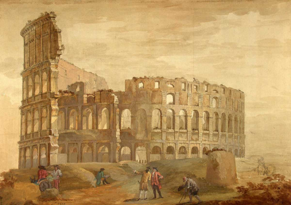
Where can you find confirmation of the fact of the disaster, except for the physical maps that we talked about above. I’m afraid to seem unoriginal, but the answer will be quite simple: firstly, under your feet and secondly, in works of art, namely in the paintings of artists. I doubt that any of the eyewitnesses would have been able to capture the wave itself, but the consequences of this tragedy were fully captured. There were quite a large number of artists who painted paintings that reflected the picture of terrible devastation that reigned in the seventeenth and eighteenth centuries in the place of Egypt, modern Western Europe and Mother Rus'. But they prudently told us that these artists did not paint from life, but depicted on their canvases the so-called world they imagined. I will cite the works of just a few fairly prominent representatives of this genre:
This is what the now familiar antiquities of Egypt looked like before they were literally dug up from under a thick layer of sand.


What happened in Europe at that time? Giovanni Battista Piranesi, Hubert Robert and Charles-Louis Clerisseau will help us understand.


But these are not all the facts that can be cited in support of the disaster and which I have yet to systematize and describe. There are also cities in Mother Rus' covered with earth for several meters, there is the Gulf of Finland, which is also covered with earth and became truly navigable only at the end of the nineteenth century, when the world's first sea canal was dug along its bottom. There are salty sands of the Moscow River, sea shells and devil's fingers, which I dug up as a boy in the forest sands in the Bryansk region. And Bryansk itself, which according to the official historical legend got its name from the wilds where it supposedly stands, really doesn’t smell like wilds in the Bryansk region, but this is a subject for a separate conversation and God willing, in the future I will publish my thoughts on this topic. There are deposits of bones and carcasses of mammoths, the meat of which was fed to dogs in Siberia at the end of the twentieth century. I will consider all this in more detail in the next part of this article.
In the meantime, I appeal to all readers who spent their time and effort and read the article to the end. Do not remain open-hearted - express any critical comments, point out inaccuracies and errors in my reasoning. Ask any questions - I will definitely answer them!
This is a modern geological theory about the movement of the lithosphere, according to which the earth's crust consists of relatively integral blocks - lithospheric plates, which are in constant motion relative to each other. At the same time, in expansion zones (mid-ocean ridges and continental rifts), as a result of seafloor spreading, new oceanic crust is formed, and the old one is absorbed in subduction zones. The theory of plate tectonics explains the occurrence of earthquakes, volcanic activity, and mountain building processes, most of which are confined to plate boundaries.
The idea of the movement of crustal blocks was first proposed in the theory of continental drift, proposed by Alfred Wegener in the 1920s. This theory was initially rejected. The revival of the idea of movements in the solid shell of the Earth (“mobilism”) occurred in the 1960s, when, as a result of studies of the relief and geology of the ocean floor, data were obtained indicating the processes of expansion (spreading) of the oceanic crust and the subduction of some parts of the crust under others ( subduction). Combining these ideas with the old theory of continental drift gave rise to the modern theory of plate tectonics, which soon became a generally accepted concept in the earth sciences.
In the theory of plate tectonics, a key position is occupied by the concept of geodynamic setting - a characteristic geological structure with a certain ratio of plates. In the same geodynamic setting, the same type of tectonic, magmatic, seismic and geochemical processes occur.
Current state of plate tectonics
Over the past decades, plate tectonics has significantly changed its basic principles. Nowadays they can be formulated as follows:
The upper part of the solid Earth is divided into a brittle lithosphere and a plastic asthenosphere. Convection in the asthenosphere is the main cause of plate movement.
The modern lithosphere is divided into 8 large plates, dozens of medium plates and many small ones. Small slabs are located in belts between large slabs. Seismic, tectonic, and magmatic activity is concentrated at plate boundaries.
To a first approximation, lithospheric plates are described as rigid bodies, and their motion obeys Euler's rotation theorem.
There are three main types of relative plate movements
1) divergence (divergence), expressed by rifting and spreading;
2) convergence (convergence) expressed by subduction and collision;
3) shear movements along transform geological faults.
Spreading in the oceans is compensated by subduction and collision along their periphery, and the radius and volume of the Earth are constant up to the thermal compression of the planet (in any case, the average temperature of the Earth's interior slowly decreases over billions of years).
The movement of lithospheric plates is caused by their entrainment by convective currents in the asthenosphere.
There are two fundamentally different types of earth's crust - continental crust (more ancient) and oceanic crust (no older than 200 million years). Some lithospheric plates are composed exclusively of oceanic crust (an example is the largest Pacific plate), others consist of a block of continental crust welded into the oceanic crust.
More than 90% of the Earth's surface in the modern era is covered by 8 largest lithospheric plates:
1. Australian stove.
2. Antarctic plate.
3. African plate.
4. Eurasian plate.
5. Hindustan plate.
6. Pacific plate.
7. North American plate.
8. South American Plate.
Medium-sized plates include the Arabian Plate, as well as the Cocos Plate and the Juan de Fuca Plate, remnants of the enormous Faralon Plate that formed much of the Pacific Ocean floor but has now disappeared in the subduction zone beneath the Americas.
The Earth's crust is divided by faults into lithospheric plates, which are huge solid blocks that reach the upper layers of the mantle. They are large, stable parts of the earth's crust and are in continuous motion, sliding along the surface of the Earth. Lithospheric plates consist of either continental or oceanic crust, and some combine a continental massif with an oceanic one. There are 7 largest lithospheric plates, which occupy 90% of the surface of our planet: Antarctic, Eurasian, African, Pacific, Indo-Australian, South American, North American. In addition to them, there are dozens of medium-sized slabs and many small ones. Between the medium and large slabs there are belts in the form of mosaics of small slabs of bark.
Theory of plate tectonics
The theory of lithospheric plates studies their movement and the processes associated with this movement. This theory states that the cause of global tectonic changes is the horizontal movement of lithosphere blocks - plates. Plate tectonics examines the interaction and movement of blocks of the earth's crust.

Wagner's theory
The idea that lithospheric plates move horizontally was first suggested in the 1920s by Alfred Wagner. He put forward a hypothesis about “continental drift”, but it was not recognized as reliable at that time. Later, in the 1960s, studies of the ocean floor were carried out, as a result of which Wagner’s guesses about the horizontal movement of plates were confirmed, and the presence of processes of ocean expansion, caused by the formation of oceanic crust (spreading), was revealed. The main provisions of the theory were formulated in 1967-68 by American geophysicists J. Isaacs, C. Le Pichon, L. Sykes, J. Oliver, W. J. Morgan. According to this theory, plate boundaries are located in zones of tectonic, seismic and volcanic activity. Boundaries are divergent, transformative and convergent.

Movement of lithospheric plates
Lithospheric plates begin to move due to the movement of matter located in the upper mantle. In rift zones, this substance breaks through the crust, pushing plates apart. Most rifts are located on the ocean floor, since the earth's crust there is much thinner. The largest rifts that exist on land are located near Lake Baikal and the African Great Lakes. The movement of lithospheric plates occurs at a speed of 1-6 cm per year. When they collide with each other, mountain systems arise at their boundaries in the presence of continental crust, and in the case when one of the plates has a crust of oceanic origin, deep-sea trenches are formed.
The basic principles of plate tectonics come down to several points.
- In the upper rocky part of the Earth, there are two shells that differ significantly in geological characteristics. These shells are the hard and brittle lithosphere and the mobile asthenosphere underneath. The base of the lithosphere is a hot isotherm with a temperature of 1300°C.
- The lithosphere consists of plates of the earth's crust continuously moving along the surface of the asthenosphere.
Indisputable proof that tectonic plates were in motion was the unprecedented flood in the history of Pakistan in 2010. More than 1,600 people died, 20 million were injured, and a fifth of the country was under water. On the opposite side of the Indo-Australian plate, the ocean floor is rising, as evidenced by buoy readings near Australia. The tilt of the plate directs water to the east coast of Australia, so in January 2011 Australia experienced the “biblical flood”, the area of flooding exceeded the total area of France and Germany, the flood is recognized as the most destructive in the history of the country. Next to station 55012 is station 55023, which in June 2010 already recorded an unprecedented rise of the ocean floor by 400 (!!!) meters. Buoy 55023 first began showing seafloor rise in April 2010, indicating not only the steady rise of the eastern edge of the Indo-Australian plate, but also flexible parts of that plate that can bend when the position of the plate changes. The plates are heavy and when they topple, they can buckle to the point where they become suspended, bending under the weight of the rock no longer supported by the magma. In essence, a void is created under this part of the slab. Sudden rapid drop in water height on June 25, 2010. actually had a connection to the 7.1 magnitude earthquake in the Solomon Islands a day later. This activity, the rise of the plate, has become stronger, and this trend will only increase in the near future. Since the end of 2010, the Sunda Plate has shown a steady decline. All countries that are on the plate - Myanmar, Thailand, Cambodia, Vietnam, Laos, China, Malaysia, the Philippines and Indonesia have experienced record floods this year. The photo shows the coastline of cities on the island of Java in Indonesia - Jakarta, Semarang and Surabaya. The photo clearly shows that the ocean has swallowed up the coastline and the coast is going under water.
Earth Observatory, a division of NASA, acknowledged that Pakistan's altitude had decreased when compared to images from a year ago.
The Indian plate is tilting, causing Pakistan to lose several meters of height.
To the east of the Indonesian island of Java, in the sea between Java and Bali, a new island has grown within a few days. A new island has appeared between eastern Java and Bali, where the Sunda Plate is under pressure as it is pushed down beneath the Indo-Australian Plate boundary. When the platform is pressed into compression, thin spots on it can begin to deform, which also exposes weak points in the platform, which can become deformed in such a way that it has to rise.
Photo of Bali, Indonesia, port on the coast underwater. This dive was sudden, within an hour. Similarly on the north coast of Java is the Semarang dive.
The sinking of the Sunda Plate has reached a stage where coastal cities such as Jakarta, Manila and Bangkok are in the news due to severe flooding problems. Bangkok, which is set to lose 12 meters of height from the Sunda Plate's subduction, has declared "war" on the rising water, which they attribute to rainfall runoff from the mountains, but in fact no rainwater not capable drain as the rivers are blocked by reflux from the sea. Local news explicitly refers to demotion, claiming that there is "sea level rise" in the Ayutthaya temple area, which is far inland from Bangkok. And Manila authorities, refusing to acknowledge what happened, are telling their rooftop population to just wait it out. Scientists are warning of land inundation in Manila and Central Luzon caused by increased flooding. The reason for the flooding of areas of land in Greater Manila and nearby provinces may be geological movements associated with processes in the valley of the Western Markina fault line.
In Thailand, floods have killed more than 800 people and affected more than 3 million. The flood is already recognized as the worst in 100 years.
10.08. Residents of the island of Luzon report that they have never seen flooding on such a scale, and the rivers in this region still hold high water levels, which for some reason do not flow into the ocean.
The reality that the Sunda Plate, which also contains Vietnam and Cambodia, is sinking is beginning to appear in the press. Press reports from Vietnam repeatedly mention that they are plunging into sea water“Heavy rains upstream and downstream over the past two days have caused Hue city to be submerged in seawater.” "This year's event is an anomaly," said Kirsten Mildren, a spokeswoman for the regional UN Office for the Coordination of Humanitarian Affairs. "Here you are in the water for weeks or months, and it just keeps getting worse."
30.09. In the Mekong River valley in southern Vietnam and Cambodia, the most powerful disaster in recent memory occurred. ten years flood. As a result, more than a hundred people died,
bridges and houses of hundreds of thousands of residents were destroyed.
The buoy near the Mariana Trench plunged into the water by 15!!! meters. The Mariana Plate tilts and moves under the Philippine Plate, and the Mariana Trench folds. The Mariana Islands will tilt and move closer to the Philippine Islands by 47 miles.
A strip of land 800 m long and 50 m wide appeared in the sea near the Taman Peninsula. Layers of clay rose 5 m above sea level.In this area, there is a weak point in the earth's crust and plate tugs occur in three directions; compression causes the earth to rise.
In southern Russia, seismic activity has increased sharply in recent years. The Azov and Black Seas are in the area of special attention. Their coastlines are constantly changing. New islands appear, or, conversely, areas of land go under water. Scientists have found that such phenomena are associated with the movement of tectonic plates. Recently, the line of the Azov coast began to change dramatically. Not a single plant, just cracked soil, rocks and sand. More recently, this land was deep under water, but literally overnight, a significant section of the bottom rose five meters up and a peninsula was formed. To understand what force lifted a piece of earth weighing hundreds of tons, experts take soil samples every day. After all measurements there is only one conclusion - tectonic plates in this area began to actively move.
http://www.vesti.ru/doc.html?id=623831&cid=7
The latest earthquake models (monitor http://www.emsc-csem.org/Earthquake/) indicate that the plates are freed, so they are moving regularly generally- using the example of recent earthquakes at the boundaries of the Antarctic, Philippine and Caribbean plates. As a result, earthquake epicenters are often located on all sides of the platform contour. On the IRIS seismic monitor on November 13, 2011, earthquakes fringing the Antarctic Plate show a clear trend. The Antarctic Plate is moving!
The strong earthquake on November 8, 2011 at the Philippine Plate boundary indicates the movement of this plate. The earthquake occurred exactly on the boundary of the Philippine Plate, and the next day there was another, smaller earthquake on the opposite side of the plate. This the plate also moves.
The November 12-13, 2011 earthquakes that fringe the Caribbean Plate show that the entire plate is moving, being pressurized below at the junction near Venezuela, off the islands of Trinidad and Tobago, uplifted near the Virgin Islands, and violently crushed where Guatemala meets with Coconut Plate. Caribbean Plate moves as one whole.
The theory of plate tectonics is a modern science about the origin and development of the Earth's lithosphere. The basic ideas of the theory of plate tectonics are as follows. Lithospheric plates are located above a plastic and viscous shell, asthenosphere. The asthenosphere is a layer of reduced hardness and viscosity in the upper part of the Earth's mantle. The plates float and move slowly horizontally through the asthenosphere.
As the plates move apart, cracks appear on the opposite side of the oceanic reefs in the middle of the valley, which are filled with young basalts rising from the Earth's mantle. Oceanic plates sometimes end up underneath continental plates, or slide relative to each other along vertical fault planes. The spreading and creeping of plates is compensated by the birth of new oceanic crust at the crack sites.
Modern science explains the reasons for the movement of lithospheric plates by the fact that heat accumulates in the bowels of the Earth, which causes convection currents mantle substances. Mantle plumes occur even at the core-mantle boundary. And cooled oceanic plates gradually sink into the mantle. This gives impetus to hydrodynamic processes. Falling plates linger for about 400 million years at a 700 km boundary, and after accumulating sufficient weight "fail"through the boundaries, into the lower mantle, reaching the surface of the core. This causes mantle plumes to rise to the surface. At the 700 km boundary, these jets split and penetrate into the upper mantle, generating an upward flow in it. A line of plate separation is formed above these currents. Under the influence of mantle flows, plate tectonics occurs.
In 1912, the German geophysicist and meteorologist Alfred Wegener, based on the similarity of the Atlantic coasts of North and South America with Europe and Africa, as well as on the basis of paleontological and geological data, proved “ continental drift" He published these data in 1915 in Germany.
According to this theory, the continents “float” on the lower basalt “lake” like icebergs. According to Wegener's hypothesis, a supercontinent existed 250 million years ago Pangea(gr. pan - everything, and gaya - Earth, i.e. The whole Earth). About 200 million years ago, Pangea split into Laurasia in the north and Gondwana on South. Between them was the Tethys Sea.
The existence of the supercontinent Gondwana at the beginning of the Mesozoic era is confirmed by the similarity of the topography of South America, Africa, Australia and the Hindustan Peninsula. Coal deposits have been found in Antarctica, indicating that in the distant past these places had a hot climate and abundant vegetation.
Paleontologists have proven that the flora and fauna of the continents that formed after the collapse of Gondwana are the same and form one family. The similarity of the coal seams of Europe and North America and the similarity of dinosaur remains indicate that these continents separated after Triassic period.
In the 20th century, it became clear that in the middle of the oceans there are seamounts about 2 km high, 200 to 500 km wide and up to several thousand km long. They were named mid-ocean ridges (CR). These ridges covered the entire planet in a ring. It has been established that the most seismically active places on the earth's surface are SKh. The main material of these mountains is basalt.
Scientists have discovered deep (about 10 km) oceanic trenches under the oceans, which are mainly located on the shores of continents or islands. They were discovered in the Pacific and Indian oceans. But there are none in the Atlantic Ocean. The deepest gutter is Mariana Trench, 11022 m deep, located in the Pacific Ocean. IN deep gutters There is great seismic activity, and the earth's crust in such places falls into the mantle.
The American scientist G. Hess suggested that the mantle material through rift (English rift - removal, expansion) cracks rises up to the central parts of the SC, and, filling the cracks, crystallizes, oriented in the direction of the Earth's magnetic field. After some time, while moving away from each other, a new crack appears again, and the process repeats. Scientists, taking into account the direction of the magnetic field of crystals of volcanic origin and the Earth, through correlation, established the location and direction of movement of continents in different geological times. Extrapolating in the opposite direction the movement of the continents, they received the supercontinents Gondwana and Pangea.
The most active place of mountain ranges is the line passing in the middle of the ridges, where faults appear that reach the mantle. The length of the faults ranges from 10 km to 100 km. Rifts divide the SH into two parts. Rifts located between the peninsula Arabia and Africa have a length of about 6500 km. In total, the length of oceanic rifts is about 90 thousand km.
Sedimentary rocks have accumulated since Jurassic period. There are no sedimentary rocks near the SKh, and the direction of the magnetic field of the crystals coincides with the direction of the Earth's magnetic field. Based on these data, in 1962, American geologists G. Hess and R. Dietz explained the reasons for the occurrence of the SH by the fact that the earth's crust under the oceans slides in the opposite direction. And for this reason, rift cracks appear and SH. The causes of continental drift are associated with the emergence of continental continents, which, expanding, push away lithospheric plates, and thereby set them in motion.
Underwater the slabs are heavy, when they meet continental plates, they fall into the Earth's mantle. Near Venezuela, the Caribbean Plate is moving under the South American Plate. In recent years, with the help of spacecraft, it has been established that the speeds of plate movement are different. For example, the speed of movement of the peninsula Hindustan to the north is about 6 cm/year, North America towards the west - 5 cm/year and Australia to the northeast - 14 cm/year.
The rate of formation of new earth's crust is 2.8 km 2 /year. The area of the SKh is 310 million km 2, therefore, they were formed over 110 million years. The age of the crustal rocks of the western Pacific Ocean is 180 million years. Over the past 2 billion years, new oceans have appeared and old oceans have disappeared about 20 times.
South America separated from Africa 135 million years ago. North America separated from Europe 85 million years ago. Hindustan plate 40 million years ago collided with Eurasian, as a result of which mountains appeared Tibet and Himalayas. Science has established that after the formation of the earth’s crust (4.2 billion years ago) as a result of tectonic processes disintegrated four times and the formation of Pangea with a period of about one billion years.
Volcanic activity is concentrated at plate junctions. Along the junction line of the plates there are volcano chains, for example, in the Hawaiian Islands and Greenland. The length of the volcanic chains is currently about 37 thousand km. Scientists believe that in a few hundred million years, Asia will unite with North and South America. The Pacific Ocean will close and the Atlantic Ocean will expand.
Questions for self-control
1. What is the name of the theory about the origin and development of the Earth's lithosphere?
2. What is the name of the layer of reduced hardness and viscosity in the upper part of the Earth’s mantle?
3. Where do the oceanic plates move apart on the opposite side?
4. How does modern science explain the reasons for the movement of lithospheric plates?
5. What plates are plunging into the Earth's mantle?
6. What causes mantle plumes to rise to the surface?
7. Who and when, based on the similarity of the Atlantic coasts of North and South America with Europe and Africa, proved “ continental drift».
8. How many millions of years ago did the supercontinent exist? Pangea?
9. How many million years ago did Pangea split into Laurasia in the north and Gondwana on South?
10. Where was the Tethys Sea?
11. Where were coal deposits found, indicating that in the distant past these places had a hot climate and abundant vegetation?
12. The flora and fauna of which continents are the same and form one family?
13. What does the similarity of coal seams in Europe and North America indicate?
14. When they found out that in the middle of the oceans there are mid-ocean ridges?
15.Mid-ocean ridges do they cover the entire planet in a ring or not?
16. Where are ocean trenches located?
17. Which oceanic trench is the deepest and where is it located?
18. How many parts are divided by rifts (cracks) of the mid-ocean ridges?
19. How many thousand km in total is the length of oceanic rifts?
20. Who and when connected the causes of continental drift with the emergence of the mid-ocean ridges?
21. Why do underwater plates, when they meet continental plates, fall into the Earth’s mantle?
22. How many cm/year is the speed of movement? North America towards the west?
23. How many cm/year is the speed of movement? Australia to the northeast?
24. How many km 2 /year is the rate of formation of the new earth’s crust?
25. How many million km 2 area mid-ocean ridges?
26. How many millions of years did they form? mid-ocean ridges?
27. For what reason do they arise? chains of volcanoes?
28. On which islands is there a chain of volcanoes?
29. How many thousands of kilometers are the length of the volcanic chains at present?
…******…
Topic 21. Environment and health


